


TNTatlas for Windows 7 - "TNTatlas: Dynamic Mapping Software" - Windows 7 Download

TNTatlas 2024 B20240606
Discover dynamic GIS mapping with TNTatlas for Windows 7.
Looking for a powerful mapping and analysis tool? Look no further than TNTatlas from MicroImages, Inc. With TNTatlas, users can combine a variety of data sources into layered maps, perform advanced spatial analysis, and generate professional-quality output. This software is perfect for researchers, educators, and professionals in fields ranging from geology to urban planning. Download TNTatlas now and start exploring the world in a whole new way!
TNTatlas 2024 B20240606 full details

| File Size: | 59.00 MB |
|---|---|
| License: | Freeware |
| Price: | FREE |
| Released: | 2024-06-06 |
| Downloads: | Total: 659 | This Month: 78 |
| Publisher: | MicroImages, Inc. |
| Publisher URL: | https://www.microimages.com/ |

Download TNTatlas 2024 B20240606
Save TNTatlas to My Stuff
Tweet

TNTatlas 2024 B20240606 full screenshots
TNTatlas - Windows 7 Download awards

TNTatlas 2024 B20240606 full description
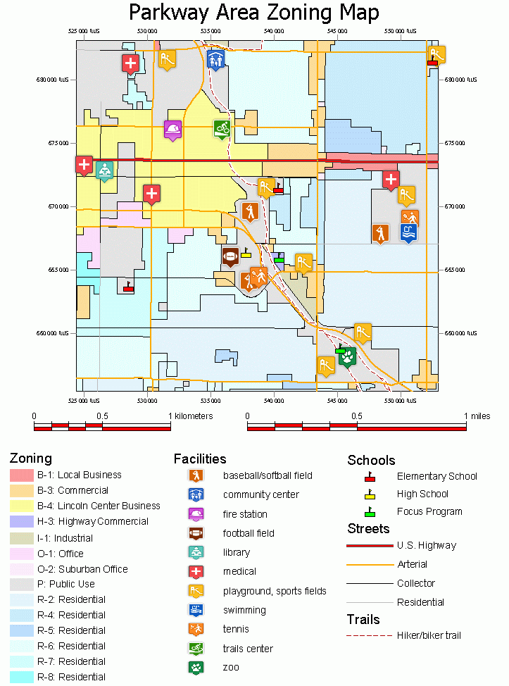
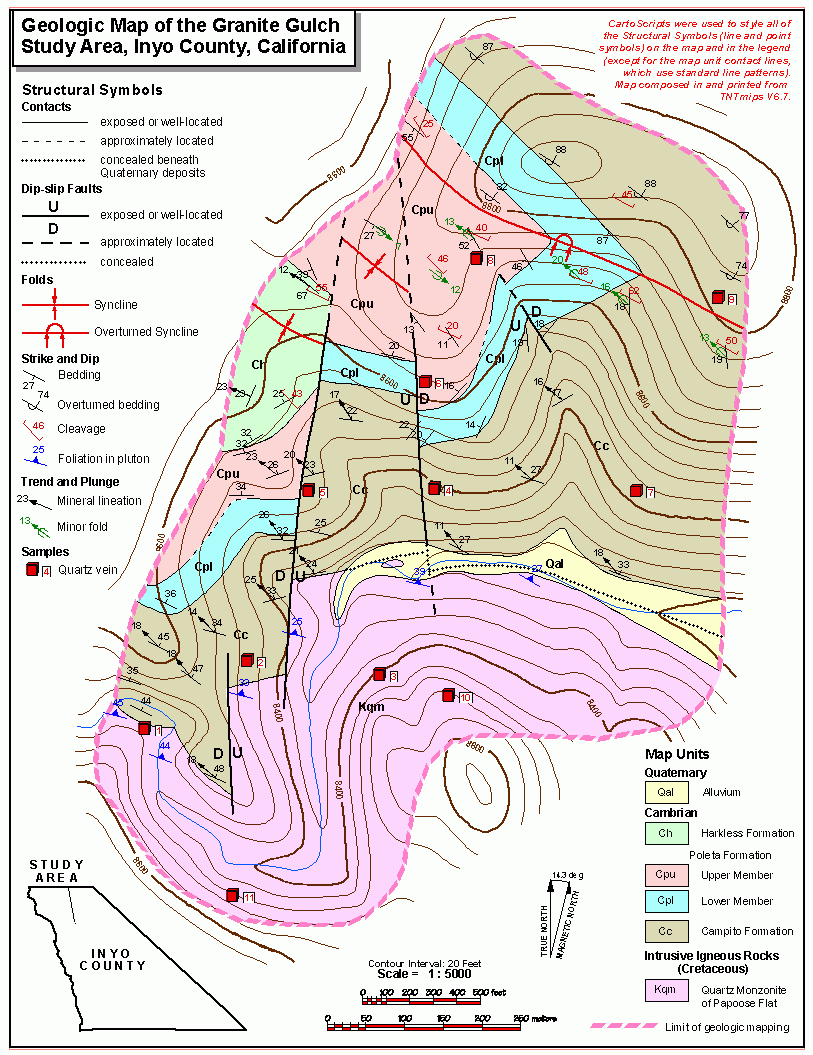
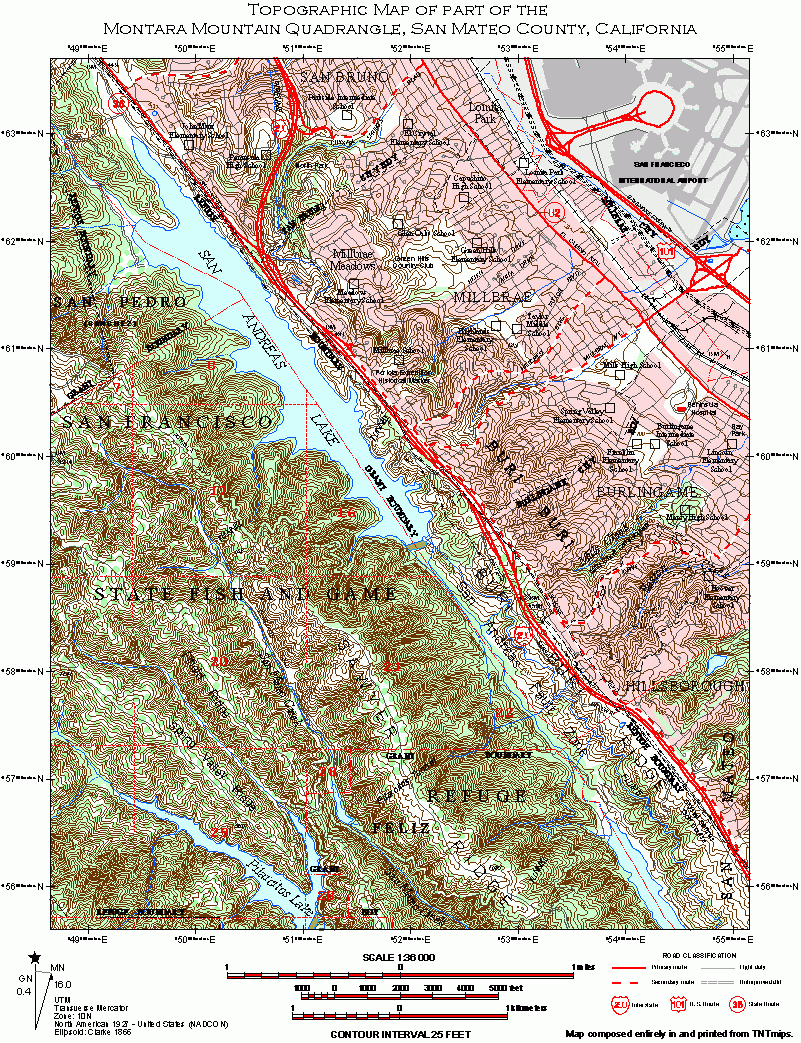
TNTatlas is a powerful free geodata viewer that lets you publish and distribute your maps and geospatial data — from a single geodata file to complex map layouts prepared using TNTmips. TNTatlas lets you display massive sized geodata and will directly display numerous file formats including shapefiles, GeoTIFF, JP2, PNG, MrSID, DXF, and DWG.
Geospatial information plays a growing part in the way we work and live. Maps, drawings, photos and related materials may be the primary concern in your professional life, or such spatial information may be a growing secondary responsibility. Your duties may include making spatial information available to a wide audience in an easily used form. You may be responsible for the distribution of sensitive corporate or military materials to a user group. Or you may have to rapidly assemble and distribute existing electronic map and database materials for those working in natural disaster relief, health and plant protection, or other time-critical management activities.
TNTatlas, from MicroImages, Inc. is the free publication tool that lets you organize, distribute, and present the spatial information in your world in an easy, atlas-like manner. With TNTatlas, you become an electronic publisher for your company, your profession, or the general public.
There was a day when the only way to widely distribute spatial information was with stacks of blueprints or a custom printed atlas or catalog. You have held a paper atlas and browsed its pages of maps, pictures, and reference tables. Where the map runs off the side of the page, you saw a note like, "for adjoining map, see page 98." When you wanted to see a more detailed map of the city or region you were looking at, you held your place with one finger and searched nearby pages or turned to the index. To view related demographic, climatologic, or economic statistics, you looked in another section for data tables or special maps.
While paper atlases and catalogs are easy to browse, they continually make you look somewhere else for supplementary materials. You must search an index or flip to another section. Today's high-capacity computer storage media make electronic publishing an economical alternative to bulky paper publication methods.
With TNTatlas, you can publish on the Internet and take advantage of the growing world-wide network, with ever-increasing bandwidth, and increased connectivity.
TNTatlas 2024 B20240606 download tags
Bookmark TNTatlas
TNTatlas for Windows 7 - Copyright information
All TNTatlas reviews, submitted ratings and written comments become the sole property of Windows 7 download. You acknowledge that you, not windows7download, are responsible for the contents of your submission. However, windows7download reserves the right to remove or refuse to post any submission for any reason.
Windows 7 Download periodically updates pricing and software information of TNTatlas full version from the publisher, but some information may be out-of-date. You should confirm all information.
Using warez version, crack, warez passwords, patches, serial numbers, registration codes, key generator, pirate key, keymaker or keygen for TNTatlas license key is illegal and prevent future development of TNTatlas. Download links are directly from our mirrors or publisher's website, TNTatlas torrent or shared files from free file sharing and free upload services, including Rapidshare, MegaUpload, YouSendIt, SendSpace, DepositFiles, DivShare, HellShare, HotFile, FileServe or MediaFire, are not used.
Post TNTatlas review


Windows 7 TNTatlas related downloads
Use it to load, view, and print plans drawn by Home Plan Pro. Send it to ...
There is a free viewer-software available for sPlan. With this viewer, everyone is able to open, view and print ...
The Sprint-Layout-Viewer was developed to be a tool that can be used to view and print ...
A scaled-down version of VariCAD. With the VariCAD Viewer, you can open, view and print your drawings. ...
... tools to the international scientific community. The Melanie Viewer 7.0 is one of these tools. This Viewer ...
My Account
Help
Windows 7 Software Coupons
-
WinX DVD Copy Pro
42% Off -
MacX DVD Video Converter
58% Off -
WinX MediaTrans
63% Off -
FREE VPN PROXY by SEED4.ME WINDOWS
Free VPN by Seed4Me -
MacX DVD Ripper Pro
50% Off
My Saved Stuff
You have not saved any software.
Click "Save" next to each software.
Click "Save" next to each software.
Would you like to receive announcements of new versions of your software by email or by RSS reader? Register for FREE!
Windows 7 Downloads Picks
- LochMaster 4.0
- BricsCad Classic 24.2.06-1
- Sweet Home 3D 7.4
- Mobile Atlas Creator 2.2.1
- Graph Streaming 0.7.0.12
- Geneious PRO x64 6.0.4
- GPS Utility 5.51
- MVSP 3.22
- DICOMscope 3.5.1
- MaxIm DL 6.05
- Melanie Viewer 7.0.7
- Geneious PRO for Vista 4.7.6
- Jmol 14.31.53
- LabCollector 4.96
- Geneious PRO 6.0.4
- VideoCAD 13.0.0.0
- Graph construction program 3.2.0
- Gephi 0.10.1
- System Sensor Voltage Drop Calculator 3.02.0040
- TinyCAD 3.00.04
Popular Tags
design
bmp
stl file
landscape
view
export
solidedge
converter
plug in
software
import
intellicad
stl
obj file
convert
autocad
viewer
dwg
solidworks
animation
cam
dxf
cad
hpgl
open
dwg viewer
home
assembly
file
architect
Popular Windows 7 Software
- CorelDRAW X7 (x32 bit) 17.4.0.887
- CorelDRAW X7 (x64 bit) 17.4.0.887
- CorelDRAW X5 15.2.0.686
- CorelDRAW X4
- iTop Screenshot 1.2.3.544
- CorelDRAW 2017 19.1.0.419
- CorelDRAW X6 16.4.0.1280
- Adobe InDesign CS5 CS5.5 7.5.3
- Graphic Workshop Professional 15.0a rev11
- Blender - 32 bit 2.80
- Model Air Design 2.4
- CorelDRAW X8 18.0.0.450
- Blender Portable 4.1.1
- Model Air Design 2.4
- Paint.NET 5.0.13
© 2025 Windows7Download.com - All logos, trademarks, art and other creative works are and remain copyright and property of their respective owners. Microsoft Windows is a registered trademarks of Microsoft Corporation. Microsoft Corporation in no way endorses or is affiliated with windows7download.com.